Rainbow Mountain Before Dawn
The hardest easy-sounding day in Peru: a short walk that happens above five thousand meters — higher than Mont Blanc’s summit — on a 3 a.m. start, for colors that need the morning sun. The altitude does not negotiate.
The short version
- Vinicunca — Rainbow Mountain — tops out just over 5,000 meters, per the alarm’s Mont Blanc comparison (the Alps’ summit sits at 4,809): this is extreme-altitude walking dressed as a photo stop, and the health facts run this page.
- The acclimatization rule is the alarm’s minimum, not caution theater: two full days at Cusco’s 3,400 meters (Sacred Valley nights count) before attempting the mountain — headaches, nausea, and worse arrive faster at 5,000 than any fitness level outruns, and tour operators’ oxygen bottles are for emergencies, not planning.
- The standard tour shape: 3–3.5 hours’ drive from a ~3 a.m. Cusco pickup, breakfast en route, the trailhead by mid-morning, and the 1.5–2 hour ascent to the viewpoint — with lunch on the return leg and the city by late afternoon.
- Horses rent along the trail per the alarm’s no-shame clause — local families run them at posted-ish rates for most of the route’s length — and turning around is the third legitimate option the altitude keeps on the table.
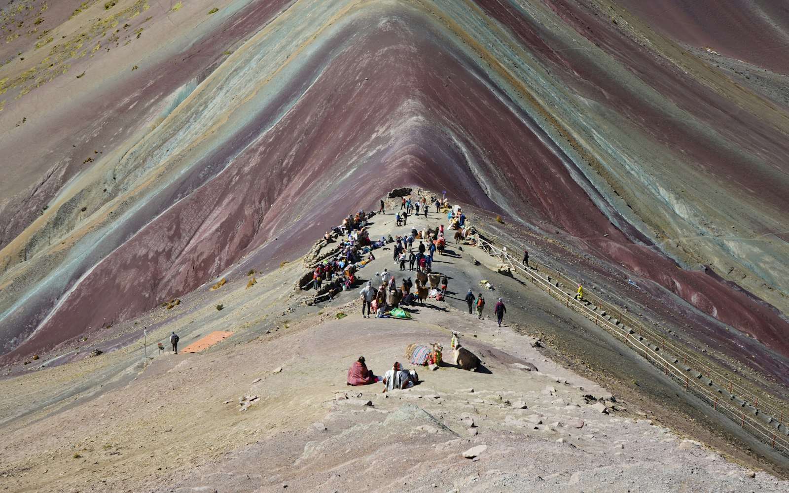
- The colors are mineral bands — iron reds, sulfur yellows, copper-tinged greens — and the morning-sun clause is optical fact: the saturation the photographs sell needs direct light, and the wet season can snow the palette over entirely; the dry months (April–October) hold the best odds, with official trip context at peru.travel.
- Palccoyo — the alternative rainbow ridge a different valley over — trades the crowd and most of the climb for a fraction of the walking at similar altitude: gentler on the body, quieter at the viewpoint, and per the alarm a choice this page respects rather than ranks.
Getting there
The tour is the format — the 3 a.m. pickup, the switchback drive into the Ausangate country, and the group pacing are the standard product at modest prices, with small-group and earlier-departure tiers buying thinner trails. The self-drive version exists for the acclimatized and stubborn; the pre-dawn mountain roads argue for the tour. The real logistics per the alarm happen before the booking: the two acclimatization days scheduled first, the coca-tea-and-hydration routine run seriously, and the honest self-assessment the altitude will conduct anyway.
The walk
The trailhead starts high and the arithmetic never improves: a gradual valley approach, the steepening final rise, and the viewpoint ridge — ninety minutes to two hours up for most, with the alarm’s horse clause covering the majority of the distance for those who take it. The pace rule is the only technique: slower than feels necessary, breath as the speedometer, and stops without apology. The viewpoint delivers the banded slope with Ausangate’s glaciers behind — morning sun willing, per the clause — and the photographs negotiate with the crowd’s rotation. Descend at the same respect; the altitude reads carelessness in both directions. Symptoms beyond a manageable headache — confusion, staggering, blue-tinged lips in a companion — are the turn-around-now signals, and every guide knows the protocol. The drive home includes the lunch stop and the nap the 3 a.m. start prepaid.
When to go
April through October is the dry season and the color season together — clearest mornings, firmest trail, coldest pre-dawn starts (layers, then shedding). November through March runs the wet gamble: green valleys, thin crowds, and the real chance of cloud or snow muting the palette per the alarm’s grey-day clause — some travelers draw the white-mountain day and call it beautiful anyway, which is the right attitude to pack. Whatever the month, the sequence holds: acclimatization days first, the earliest tour tier you’ll pay for, and the morning sun as the bonus you positioned for rather than the promise you bought.
Frequently Asked Questions
How dangerous is the altitude really?
Serious enough to run the page: 5,000-plus meters produces acute mountain sickness in unacclimatized visitors at high rates, and the rare severe forms (cerebral and pulmonary edema) are emergencies. The two-day rule, hydration, patient pacing, and a willingness to turn around manage the risk to reasonable — skipping the acclimatization is how the bad stories start.
Do the photos oversell the colors?
The saturation is usually edited upward, and the alarm’s morning-sun clause is the plain physics — in direct light the bands are genuinely striking; under cloud they’re subtle geology. Calibrate on the real thing being a mountain, not a poster, and the viewpoint delivers.
Is the horse embarrassing?
No — per the alarm, no shame rides on them: the rental string exists because the altitude, not fitness, is the variable, and locals price the service fairly along most of the route. The final viewpoint rise is walked by everyone; the horse handles the approach that costs the most oxygen.
Rainbow Mountain or Palccoyo, really?
Vinicunca for the classic view and the full (hard) experience; Palccoyo for similar banded geology at a fraction of the walking and crowd — gentler on arrival day counts, though the altitude remains real at both. Photographers lean Vinicunca on clear mornings; sensible itineraries with doubts choose Palccoyo without regret, per the alarm’s respect clause.
Can I combine this with Machu Picchu?
In one trip, absolutely — in useful order: this network’s Machu Picchu page runs at a merciful 2,430 meters, so the sane sequence does Cusco acclimatization, then Rainbow Mountain, then the sanctuary as the recovery act (or MP first and the mountain after the extra days help). Back-to-back 3 a.m. starts are the itinerary error the whole week regrets.